


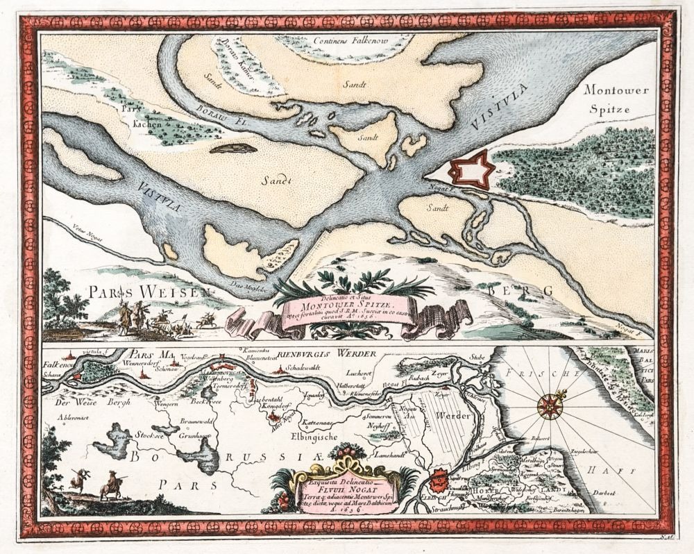
PLANY I WIDOKI MIAST POLSKICH - WOJEWÓDZTWO POMORSKIE | CYPEL MĄTOWSKI
Plan umocnień na Cyplu Mątowskim w 1656 r. (Delineatio et Situs / Montower Spitze...) oraz – poniżej, w osobnej ramce – plan dolnego biegu Nogatu i jego ujście (Exquisita Delineatio / Fluvii Nogat...); według rys. Erika Jönssona Dahlbergha, pochodzi z: Pufendorf, Samuel, Histoire Du Regne De Charles Gustave Roy De Svede..., wyd. Christoph Riegel, Norymberga 1697; miedz. kolor., st. bdb., złożenie książkowe, naprawione rozdarcie górnego marginesu; wymiary płyty: 307x247 mm; [Dantiscum... G104/2, Von Danzig... 199, Dahlbergh... 71, Kartografia... 7]


Recently viewed
Please log in to see lots list
Favourites
Please log in to see lots list