


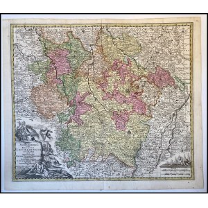
Matthaus Seutter (1678-1756)
Mappa Geographica Ducatus Lotharingiae et Barr ut et Episcopatuum Metens. Tullens. Verdunens. Territoria
Engraving, hand coloured, 57,5 x 49,5 cm
Map depicting the Lorraine region in France, title block with the title on the bottom and characters on the left depicted while hunting and producing wine and cheese. Printed in Nuremberg in 1730 c.
Sheet in perfect condition.


Ostatnio oglądane
Zaloguj się aby zobaczyć listę pozycji
Ulubione
Zaloguj się aby zobaczyć listę pozycji